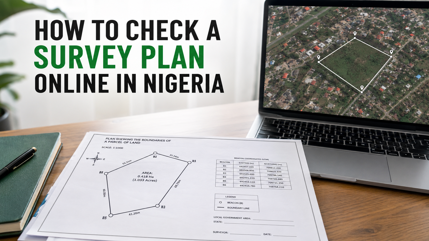
How to Check a Survey Plan Online in Nigeria: A Step-by-Step Guide
How to Check a Survey Plan Online in Nigeria: A Step-by-Step Guide
Buying land in Nigeria is a major financial decision. Unfortunately, some buyers pay for land without confirming whether the location, size and other information supplied by the seller agree with what is shown on the survey plan.
A seller may claim that a property is in a desirable area, while its coordinates point to a completely different location. The stated land size may also be different from the area covered by the coordinates.
This is why checking a survey plan should be an important part of your due diligence before paying for land.
In this guide, you will learn how to check a survey plan online in Nigeria using VerifyLand.
What Is a Survey Plan?
A survey plan is a document prepared by a registered surveyor to show the location, dimensions and boundaries of a parcel of land.
It usually contains important information such as:
- The name of the landowner
- The location of the property
- The survey plan number
- The land area
- Beacon numbers
- Bearings and distances
- Easting and northing coordinates
- The surveyor’s name, signature and registration details
- The coordinate system, datum and zone used
The coordinates are particularly important because they can be used to plot the land and view its actual position on a map.
Why Should You Check a Survey Plan?
A survey plan may look professional while containing incorrect, misleading or mismatched information. Checking it can help you identify certain problems before making a financial commitment.
An online survey plan check can help you:
- Confirm the actual location represented by the coordinates
- Visualise the land boundary on a satellite map
- Calculate the approximate land area
- Compare the calculated area with the size claimed by the seller
- Identify nearby roads, buildings, schools, markets and infrastructure
- Detect nearby water bodies or difficult terrain
- Check whether the land falls within a listed estate
- Share the findings with your lawyer or surveyor for further investigation
This is especially useful for Nigerians living abroad or buyers who cannot immediately visit the property.
How to Check a Survey Plan Online in Nigeria
VerifyLand provides a survey plan online checker that allows you to analyse land coordinates from your phone or computer.
Follow these steps:
Step 1: Obtain a Clear Copy of the Survey Plan
Ask the seller, estate developer or agent for a clear copy of the survey plan.
Ensure that the coordinates, bearings, distances, datum and zone are visible. Avoid relying only on photographs of the land or verbal descriptions from an agent.
Step 2: Visit VerifyLand
Go to www.verifyland.com.ng and select the option to start a property verification.
You can also use the VerifyLand Android application.
Step 3: Enter or Upload the Survey Plan Details
You can manually enter the coordinates shown on the survey plan.
Alternatively, upload a clear photograph of the document. VerifyLand’s AI-powered scanning feature can read relevant information such as:
- Easting coordinates
- Northing coordinates
- Bearings
- Distances
- Datum
- Coordinate zone
Always review the extracted information and compare it with the original document before continuing.
Step 4: Generate the Verification Result
After submitting the required information, VerifyLand plots the coordinates and analyses the land.
The result can show:
- The plotted land boundary
- The actual location indicated by the coordinates
- The calculated land area
- Satellite imagery of the property
- Surrounding roads and developments
- Nearby schools, markets and other features
- Possible location or size discrepancies
- Listed estates associated with the location, where available
Step 5: Compare the Result With the Seller’s Claims
Carefully compare the result with what the seller or agent told you.
Ask questions such as:
- Do the coordinates point to the location advertised?
- Does the calculated size agree with the size on the survey plan?
- Is the land close to the road or landmark mentioned by the seller?
- Does the satellite image reveal water, difficult terrain or unexpected development?
- Is the land situated within the estate claimed by the seller?
If the seller says the land is in one town or neighbourhood but the coordinates point elsewhere, do not ignore the discrepancy.
Step 6: Download and Share the Report
Download the digital verification report and keep it as part of your property records.
You can share the report with your lawyer, registered surveyor or another qualified professional for further due diligence.
Can VerifyLand Confirm That a Survey Plan Is Genuine?
VerifyLand helps you analyse the coordinates and other geographical information supplied on a survey plan. It can show where the coordinates point, calculate the land area, display the surroundings and identify certain inconsistencies.
However, an online coordinate check alone does not prove ownership or replace an official land-registry search.
To determine whether a survey plan was genuinely prepared by the named surveyor, whether the land is under government acquisition, or whether the seller has a valid legal title, you may still need:
- A registered surveyor
- A property lawyer
- A physical site inspection
- A search at the appropriate state land registry
- Confirmation from the relevant surveyor-general’s office or government authority
Online verification should therefore be treated as an important first layer of due diligence, not the only investigation required before buying land.
What If the Survey Plan Does Not Have Coordinates?
If the document does not contain readable coordinates, you may not be able to plot it accurately online.
Ask the seller for a complete and clear survey plan. You can also engage a registered surveyor to inspect the land, locate the beacons and take the necessary measurements.
Avoid paying for land when the seller refuses to provide sufficient documentation for proper verification.
Can You Check Land Without Visiting the Location?
You can conduct an initial check remotely using the survey-plan coordinates and satellite imagery.
This can help you understand the land’s location, shape, approximate size and surroundings before arranging a visit. It is particularly helpful when comparing different properties or checking a property offered to you from another state or country.
Nevertheless, a physical inspection remains advisable before completing the purchase. VerifyLand also allows users to request an on-ground inspection when additional confirmation is needed.
Warning Signs to Look Out for
Exercise caution if:
- The seller refuses to provide the survey plan
- The coordinates point to a different location
- The calculated land size is smaller than advertised
- The seller pressures you to pay immediately
- The property description is vague
- Important parts of the survey plan are blurred or covered
- The beacon numbers cannot be located on the ground
- The name on the documents does not correspond with the person selling the land
- The seller discourages you from involving a lawyer or surveyor
One discrepancy does not automatically establish fraud, but it should be investigated before payment.
Check Before You Pay
Never rely solely on an agent’s description, a signboard or a physical visit when buying land. The coordinates on the survey plan may reveal important facts that are not immediately visible at the site.
With VerifyLand, you can enter or upload survey-plan information, view the land on a satellite map, calculate its size, examine nearby features and identify possible discrepancies within minutes.
Start your survey plan check at www.verifyland.com.ng before committing your money.
Verify the location. Confirm the size. Understand the surroundings. Check before you pay.