Online Survey Plan Checker: How It Works in Nigeria
Online Survey Plan Checker: How It Works in Nigeria
Before buying land in Nigeria, it is important to confirm that the information provided by the seller agrees with the details on the survey plan. One way to begin this process is by using an online survey plan checker.
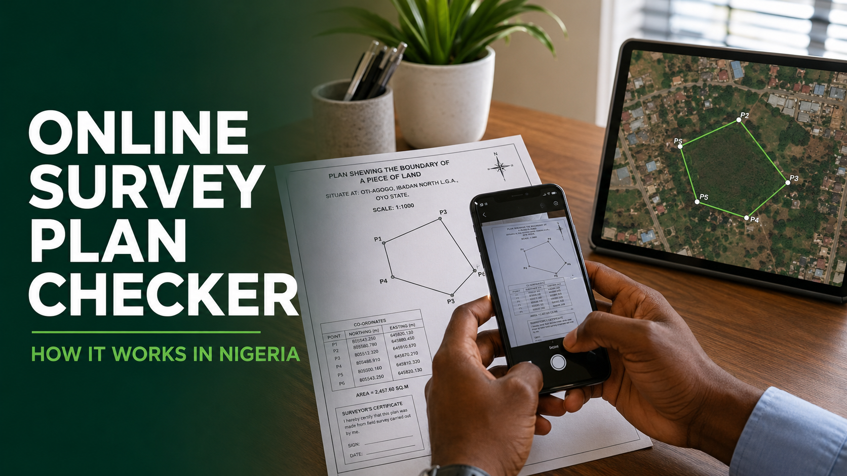
An online survey plan checker uses the coordinates on a survey plan to plot the land on a digital map. This allows you to see the actual location, boundary, approximate size and surrounding environment of the property before making payment.
This article explains how an online survey plan checker works in Nigeria, the information it can reveal and its limitations.
What Is an Online Survey Plan Checker?
An online survey plan checker is a digital tool that analyses the geographical information contained in a survey plan.
Every properly prepared survey plan should contain coordinates representing the boundary points of the land. These coordinates usually appear as easting and northing values.
When entered into an online checker, the coordinates are plotted on a satellite map to show the parcel of land they represent.
With a platform like VerifyLand, users can enter the coordinates manually or upload a clear photograph of the survey plan for automatic extraction.
What Information Is Needed?
To check a survey plan online, you will normally need some of the following information:
- Easting coordinates
- Northing coordinates
- Bearings and distances
- Coordinate datum
- Coordinate zone
- Number of boundary points
- Land area stated on the survey plan
The datum and zone are particularly important because they help the system interpret the coordinates correctly. Using an incorrect zone or coordinate system may cause the land to appear in the wrong location.
If you are unsure about any information on the survey plan, consult a registered surveyor before proceeding.
How Does an Online Survey Plan Checker Work?
The process generally involves the following stages.
1. The Survey Plan Details Are Entered
The user enters the coordinates and other required details from the survey plan into the online checker.
On VerifyLand, users can also upload a photograph of the document. The platform’s AI-powered scanning feature reads relevant details and automatically fills the available fields.
The extracted information should always be compared with the original survey plan before submitting it.
2. The Coordinates Are Processed
The checker reads the easting and northing values together with the selected datum and zone.
These values represent the positions of the land’s boundary points. The system processes them to determine where the property is located geographically.
3. The Land Boundary Is Plotted
The boundary points are joined together to form the shape of the land.
This plotted boundary is displayed on a satellite map, allowing the user to see the actual location represented by the survey-plan coordinates.
4. The Land Area Is Calculated
The system calculates the approximate area enclosed by the plotted boundary.
This can then be compared with the land size stated on the survey plan or advertised by the seller. If the seller claims that the land measures 600 square metres but the coordinates produce a considerably smaller area, the difference should be investigated.
5. The Location and Surroundings Are Analysed
The checker examines the location and nearby environment.
Depending on the information available, the result may show:
- The actual town or area represented by the coordinates
- Nearby roads and buildings
- Schools, markets and other facilities
- Water bodies and visible terrain
- Existing development around the property
- Listed estates associated with the location
- Possible discrepancies in the seller’s description
This can be useful when a property is being advertised under the name of a more popular or expensive neighbourhood while its coordinates point somewhere else.
6. A Digital Report Is Generated
After the analysis, the user can receive a digital verification report containing the available findings.
The report can be downloaded and shared with a lawyer, registered surveyor or other professional involved in the property transaction.
What Can an Online Survey Plan Checker Reveal?
An online survey plan checker may help you discover that:
- The coordinates point to a different location from the one advertised
- The calculated land area differs from the seller’s claim
- The property is close to a water body
- The land is farther from a major road than described
- The surroundings are less developed than advertised
- The property falls within a listed estate
- The coordinates or boundary information require further professional review
Discovering these issues early can help you ask the right questions before paying for the property.
Who Can Use an Online Survey Plan Checker?
An online survey plan checker can be useful for:
- Individuals planning to buy land
- Nigerians living abroad
- Property investors
- Lawyers conducting due diligence
- Registered surveyors
- Estate developers
- Real estate agents
- Banks and other organisations assessing property
It is especially helpful for buyers who want to conduct an initial investigation before travelling for a physical inspection.
Can It Confirm That a Survey Plan Is Genuine?
An online checker can confirm what the coordinates represent geographically, but coordinate analysis alone cannot prove that a survey plan is legally genuine.
For example, it may show the land’s location, shape and approximate size. However, it may not independently confirm:
- Whether the named surveyor prepared the document
- Whether the survey plan was officially lodged
- Whether the seller legally owns the property
- Whether the land is free from government acquisition
- Whether there are disputes, mortgages or other interests affecting the land
- Whether the title documents are authentic
These matters may require government charting, a land-registry search, a registered surveyor and a property lawyer.
Online Survey Check and Government Charting Are Not the Same
An online survey-plan check and official government charting serve different purposes.
An online check plots and analyses the coordinates to reveal the location, boundary, area and surroundings of the land.
Government charting is conducted through the appropriate government office to determine the official status of the land. It may reveal whether the land falls within a government acquisition, committed area, scheme or another restricted location.
For proper due diligence, buyers may need both forms of investigation.
Should You Still Visit the Land?
Yes. An online survey plan checker should support, not replace, a physical inspection.
Satellite imagery may not show every recent development or dispute affecting a property. During an inspection, a registered surveyor can help identify the beacons, confirm the boundaries and compare the physical land with the survey plan.
A lawyer can also investigate the ownership history and relevant title documents.
How to Use VerifyLand’s Online Survey Plan Checker
To check a survey plan with VerifyLand:
- Visit www.verifyland.com.ng.
- Select the option to start a verification.
- Enter the survey-plan coordinates or upload a clear photograph of the document.
- Review the extracted details carefully.
- Submit the information for analysis.
- Examine the plotted boundary, location, size and nearby features.
- Download the verification report.
- Arrange a physical inspection or further professional investigation when necessary.
Check the Survey Plan Before You Pay
A survey plan contains more than lines and numbers. Its coordinates can reveal where the land is actually located, the area covered by its boundary and important features surrounding it.
An online survey plan checker makes this information easier to understand by plotting the land on a satellite map and presenting the findings in a digital report.
Before paying for land, use VerifyLand to conduct an initial check. If the result reveals a location mismatch, size discrepancy or another concern, investigate it with a registered surveyor and property lawyer.
Visit www.verifyland.com.ng to check your survey plan online.